| FROM THE LOG #82
Reunion Island
|
 A hard day at my mobile office |
| Click on any photo or map for a blow up. (Then remember to close it also) |
|
| View from the main breakwater towards the starboard light on the southern breakwater. The entrance looks worse than it is. |

The only problem we can think of here is the strong prevailing E-ly wind (at least in September - October 2012), which usually picks up around 8-9 in the morning and blows at 20-30 knots, gusting to 35, until sundown. The reason for visiting boats experiencing difficulties is that one, under these circumstances, enters the harbour down-wind and most yachts try to make a sharp u-turn to starboard and tie port side to the town quay. Some have had problems with getting the bow all the way up in the wind and crashed into the concrete wall. Before starting the turn, I suggest curving in as far to port as possible, partly behind the first E-dock on your port side (see photos).
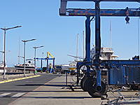
The harbour has two big travellifts and very good hard-standing areas on the break-water. They do not, however, have any cradles or other systems to support the yachts, so those would have to be constructed, which should be possible with local help. If we had known about this possibility in May, we might have chosen to leave Scorpio here instead of Port Louis. I always prefer to lift the boat out of the water when we leave her for a longer period.
Reunion is an overseas department of France and part of both the EU and the Eurozone. The first European discovety of the island was made by the Portugeuse in the early 1500s, but they left the place virtually untouched. It came under French rule in the 1600s and was administered from Mauritius. St Pierre is quite a charming place and very French - both the language (getting by with only English is a challenge) and the atmosphere, it is almost as being somewhere on the French Riviera.
Reunion is great for walks, but we chose to explore by car. Other cruisers went trekking for 2-3 days, staying over night in huts along the tracks. Piton de la Fournaise is an active volcano, which last eruption occured in 2010. The summit of this peak is around 2,600 m, but the highest point on the island is the extinct volcano Piton des Neiges at 3,070 m.
Also the marina scene is very French. This is a scene familiar from many other French over-seas territories, in the Caribbean and in Polynesia, for instance. There's a lot of people living aboard their under-repair-yachts, dreaming about sailing to destinations far away. Walking along the docks in Saint Pierre, here are a few examples:
Our plan was to leave for South Africa tomorrow, on Monday, the 15th. However, there is suddenly an early tropical cyclone on the horizon. TC ANAIS is the first tropical cyclone this year. Unfortunately they are off to an early start, last year the first cyclone formed in December. ANAIS formed near Diego Garcia, in the same area where we had a threat earlier this year. Here is an estimate, by France Meteo, of the course this cyclone will take. Unfortunately there are other, different, projections also making decision making hard.
However, if you are reading this after the 15th you will know that we have departed anyway, otherwise this paragraph would have been rephrased. |


[PREVIOUS] |
[NEXT] |